April 10, 2025
Ports and harbors play a crucial role in global trade and transportation. To keep these waterways functional and safe, regular maintenance is essential. One of the […]
March 18, 2025

Construction projects often involve digging, drilling, and excavation. Hitting underground utilities can cause delays, safety risks, and expensive repairs without proper planning. This is where Subsurface […]
March 10, 2025

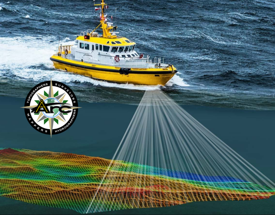
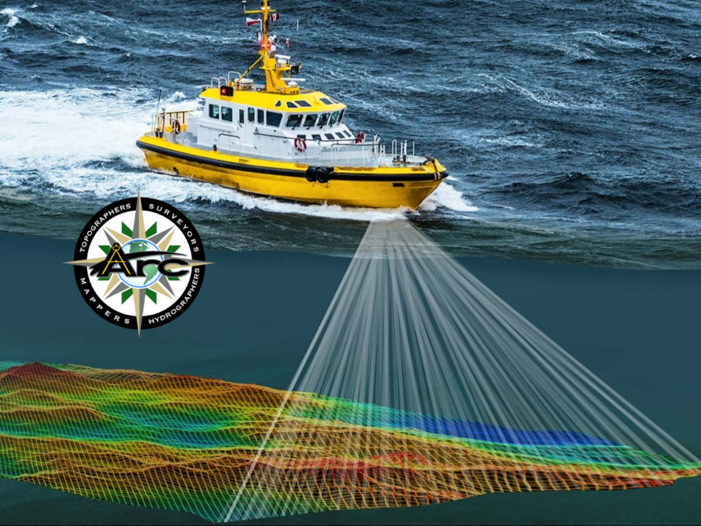
Hydrographic surveys are essential for navigation, marine construction, and environmental monitoring. Traditional methods require time-consuming and costly efforts. Now, with Multi-Beam Sonar Technology, hydrographic surveys are […]
February 25, 2025

Surveying and mapping have evolved significantly over the years. With the rise of remote sensing, professionals can now gather accurate data faster than ever. This technology […]
February 13, 2025

A topographical survey might sound technical, but its purpose is simple: to map the natural and man-made features of a piece of land. Whether you’re planning […]
January 29, 2025

AI-Powered Surveying: What the Future Holds for Data Analysis Artificial intelligence (AI) is transforming the surveying industry. From land surveys to hydrographic mapping, AI enhances efficiency, […]