ENVIRONMENTAL REMEDIATION SURVEY
...
INDIANA RIVER LAGOON, BREVARD COUNTY, ROCKLEDGE FLORIDA
Florida’s Indian River Lagoon (IRL), is considered to be North America’s most biologically diverse estuary and is choking in muck. The lagoon stretches 165 miles along the length of Florida’s East Coast.
There are no inlets or exchanges with the Atlantic Ocean for 90 miles and only minimal tidal fluctuations; therefore, no sediment flushing of the Indian River Lagoon occurs.
Dolphins and Manatees skim the surface; seagrasses cradle young marine life; migrating birds soar over the olive brown waters that threaten 2,100 species of plants, more than 2,200 species of animals, 700 fish species and 310 bird species.
It has been said that the contaminated sediment problem in the IRL is so critical that it has reached a tipping point and may be beyond recovery soon. It is well known that the muck must be removed to bring the lagoon back to a natural condition. What was not known, until an Arc/Aquares survey, was how to determine the exact location, thickness or the quantity of muck to be removed.
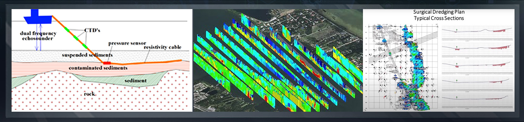
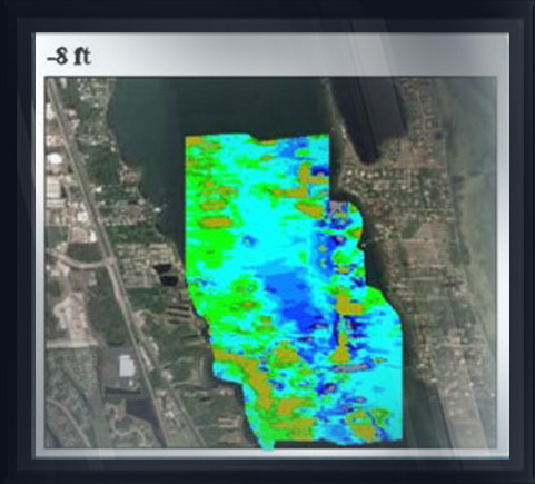
Arc performed a “Muck Test Survey” in the Indian River Lagoon. The objective of the survey was to locate the aerial position; the top and bottom (interface of muck with the natural uncontaminated bottom) using advanced geophysical techniques and to develop a plan for surgical excavation of muck.
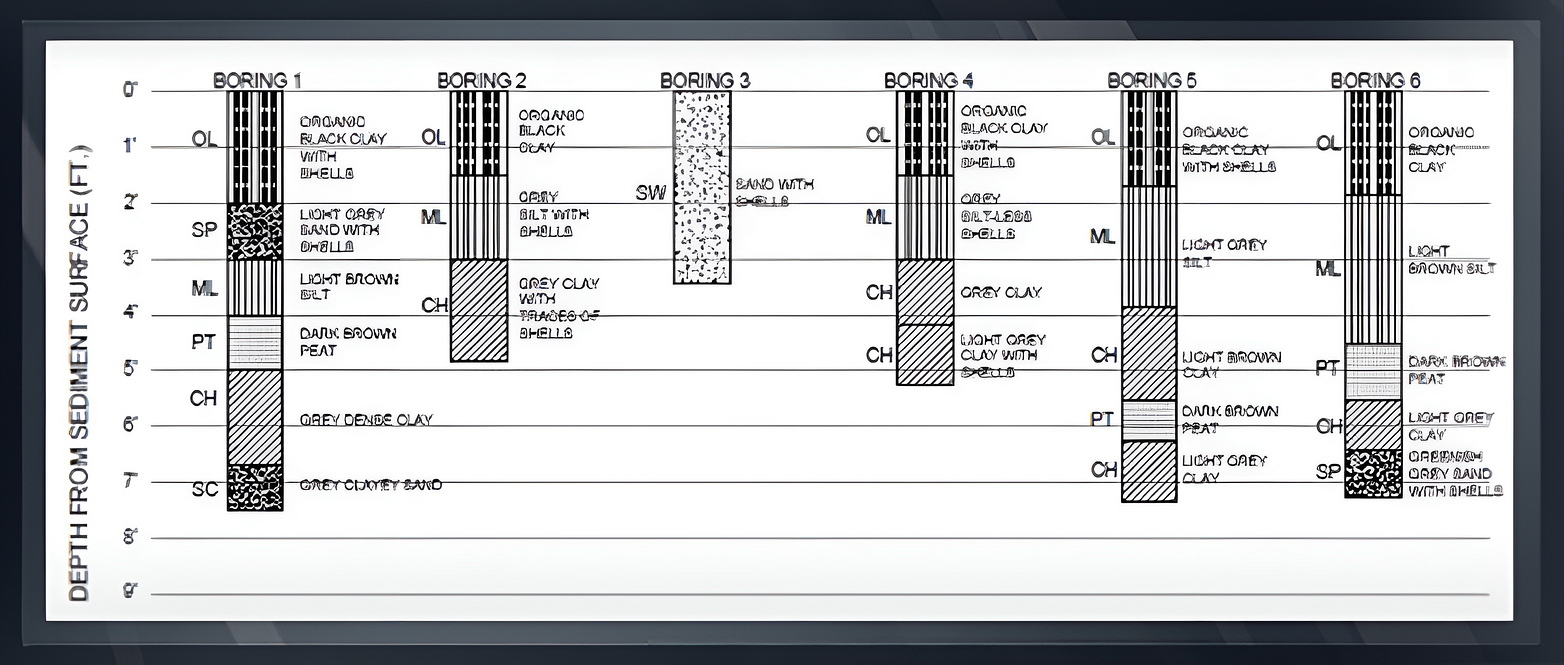
The Rockledge site was chosen since the Florida Institute of Technology (FIT) had previously surveyed the area attempting to locate and quantify muck by manual probing.
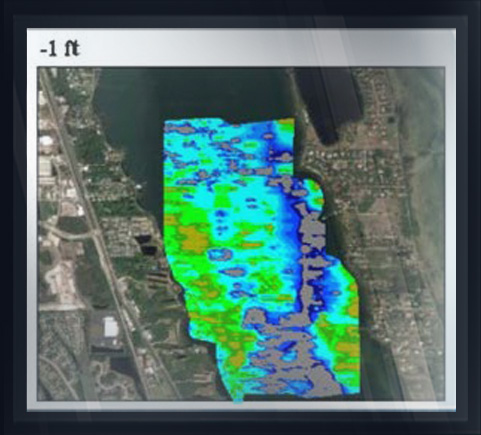
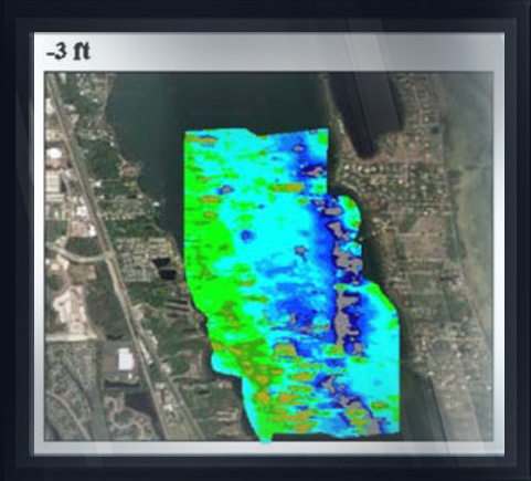
The Arc/Aquares resistivity survey generated 100% coverage of the test area waterway bottom surface producing a four-dimensional (4D) model of the subsurface (X, Y, Z and Resistivity value) of each material change, isolating the area of contaminated sediment to 1/3rd of the waterway. The exact position and thickness of contaminated muck was obtained, including the interface with native bottom.
An independent geotechnical firm obtained Vibracore samples confirming the results of the resistivity survey. Samples were tested and chemical analysis performed.
This advanced method of survey substantially reduces dredging costs by identifying areas for surgical excavation of only contaminated sediments, reducing unnecessary excavation of uncontaminated sediments to be placed in expensive and scarce disposal areas.