FLAGLER MEMORIAL BRIDGE
...
FORT LAUDERDALE, FLORIDA
DEFORMATION SURVEY
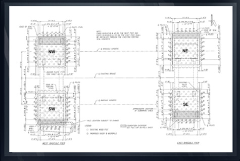
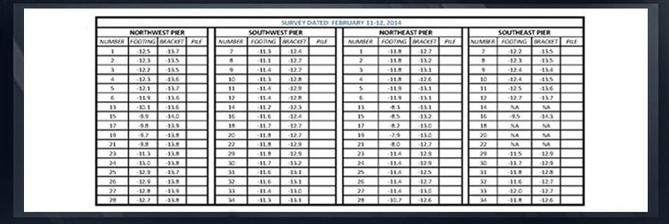
Deformation surveys of the Flagler Memorial Bridge, Flagler County Florida were performed on a monthly basis over a six-month period as Arc Surveying and Mapping, Inc. monitored the bridge for movement.
Targets were placed at strategic locations predetermined by FDOT engineers and surveyed during three (3) separate daily intervals, establishing a mean xyz value for each target at varying temperatures.
Monthly surveys were performed in the same manner. Images illustrating the target areas and variances delineating movement were provided on the image and a detailed spreadsheet.
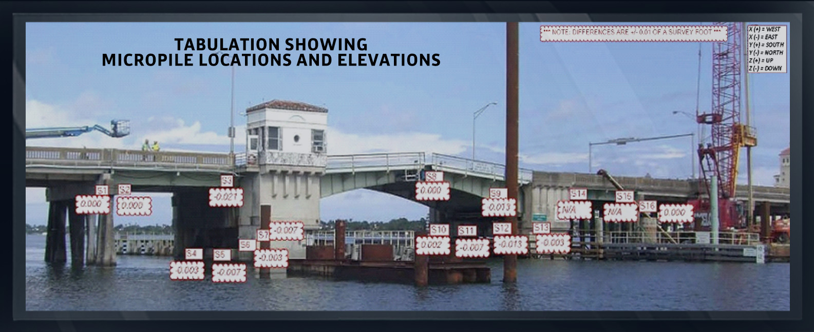
In addition, Arc located the top elevations and positions of underwater micropiles placed around the bridge support structures.
Settlement of the structure was adjusted by jacking the micropiles based on the results of Arc’s monthly deformation survey.
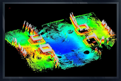
A Riegl VZ 400 terrestrial laser scanner, a Reson 7125 multibeam swath sounder and a Blueview 5000 tripod mounted sonar scanner were utilized on this project.