CENTRAL & SOUTH FLORIDA WATER CONTROL STRUCTURES
...
JACKSONVILLE, FLORIDA
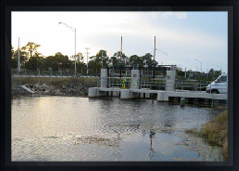
Arc was tasked under its A/E contract for surveying and mapping services with the Jacksonville District Corp of Engineers to provide a benchmark elevation on 326 water control structures spanning parts of Central and South Florida.
The purpose of the survey was to establish elevations at each structure referenced to a common vertical datum plane that would span from the Southwest Coast of Florida to the Southeast Coast of Florida and to include portions of the Florida Everglades and the Northern portion of the Florida Keys.
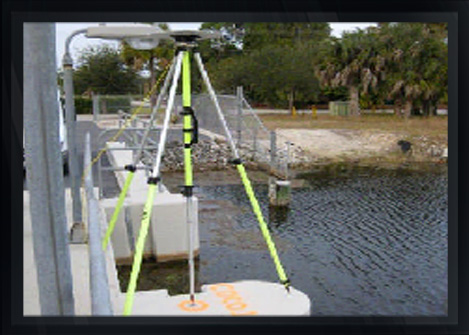
The obvious efficiencies and specific mention of GPS technology in the scope led to the choice of GPS as the primary 3D positioning technology for this survey.
...
The overall task of determining the elevations of some 326 structures was divided into five different spatially delimited networks tied to over 50 NGS Control Stations.
Sufficient observations for a fixed solution of the integer ambiguity were collected for each baseline and all baselines were processed and validated by loop closure analyses, as well as a free network adjustment performed using Trimble's Network module.
Deliverables for the project included:
a.) Structure Sheets
b.) Occupation Records
c.) Digital Photographs
d.) Shape Files
e.) Adjustment Reports and
f.) Trimble Geomatics Office Project.
All data was compiled into a Google Earth kmz file with hyperlinks to survey backup data for each of the 326 structures.
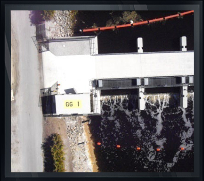
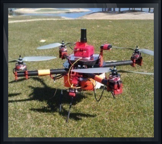
Also of interest is the fact that Arc, recognizing the advantages of new technology, chose a GPS-controlled drone to take photographs of the 325 structures during this ACOE project accounting for photographs from angles that could not be achieved by other methods.