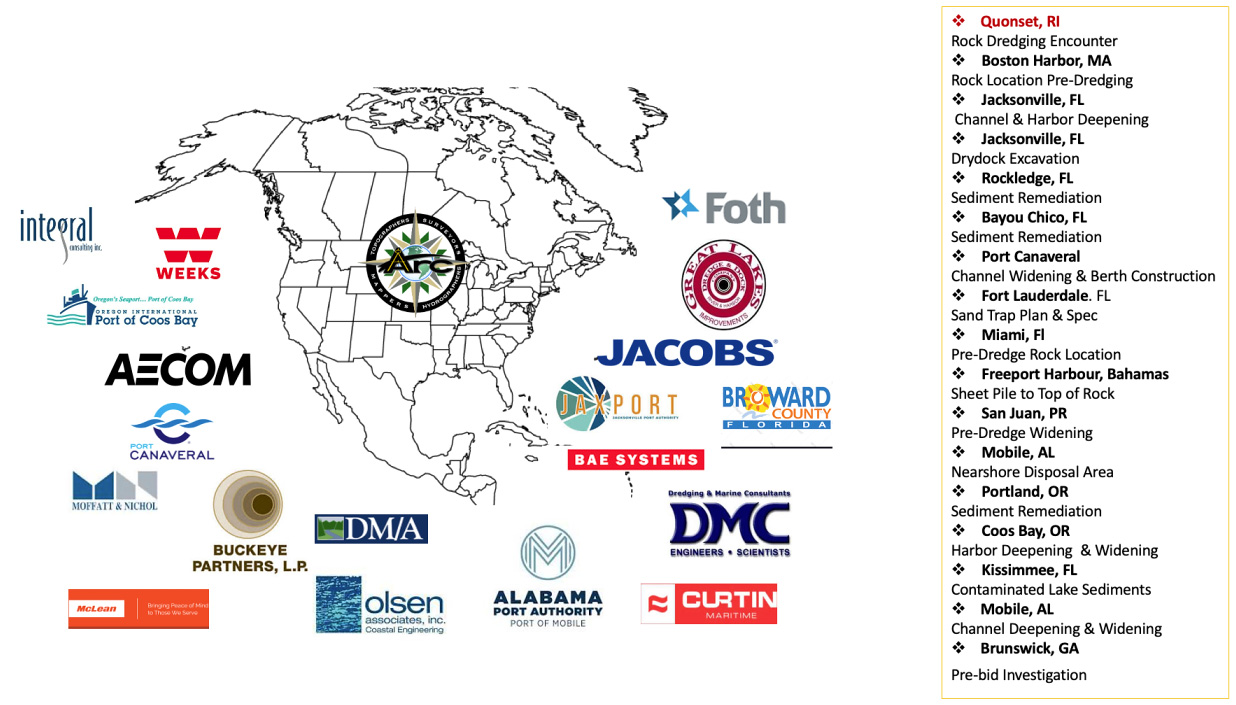
Arc Surveying & Mapping is a leading provider of marine geophysical survey services in the United States and the Caribbean. Our team of skilled geophysicists, data analysts and 3D modelers work together to collect and process subsurface data, providing clients with clear and actionable insights. With years of experience in the field, Arc Surveying & Mapping has established itself as a trusted name in geophysical surveying,— especially on port deepening and widening projects. Arc is equipped with the latest technological advancements to ensure that clients receive the most accurate data.
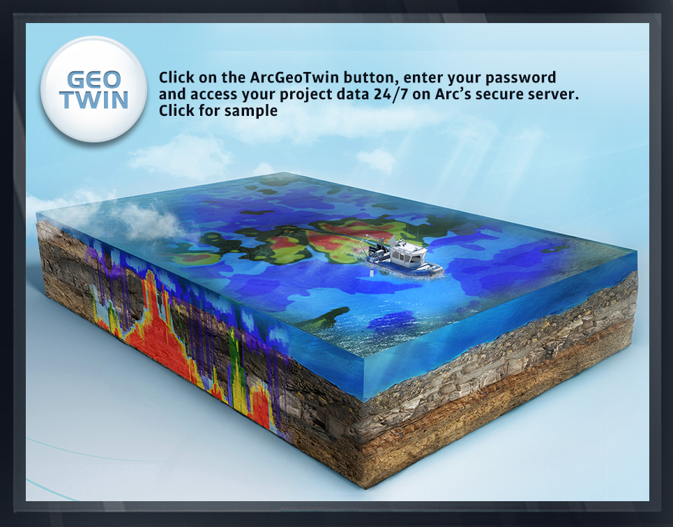
GEOPHYSICAL SAMPLES
CLICK ON IMAGE FOR DESCRIPTION
Case Studies

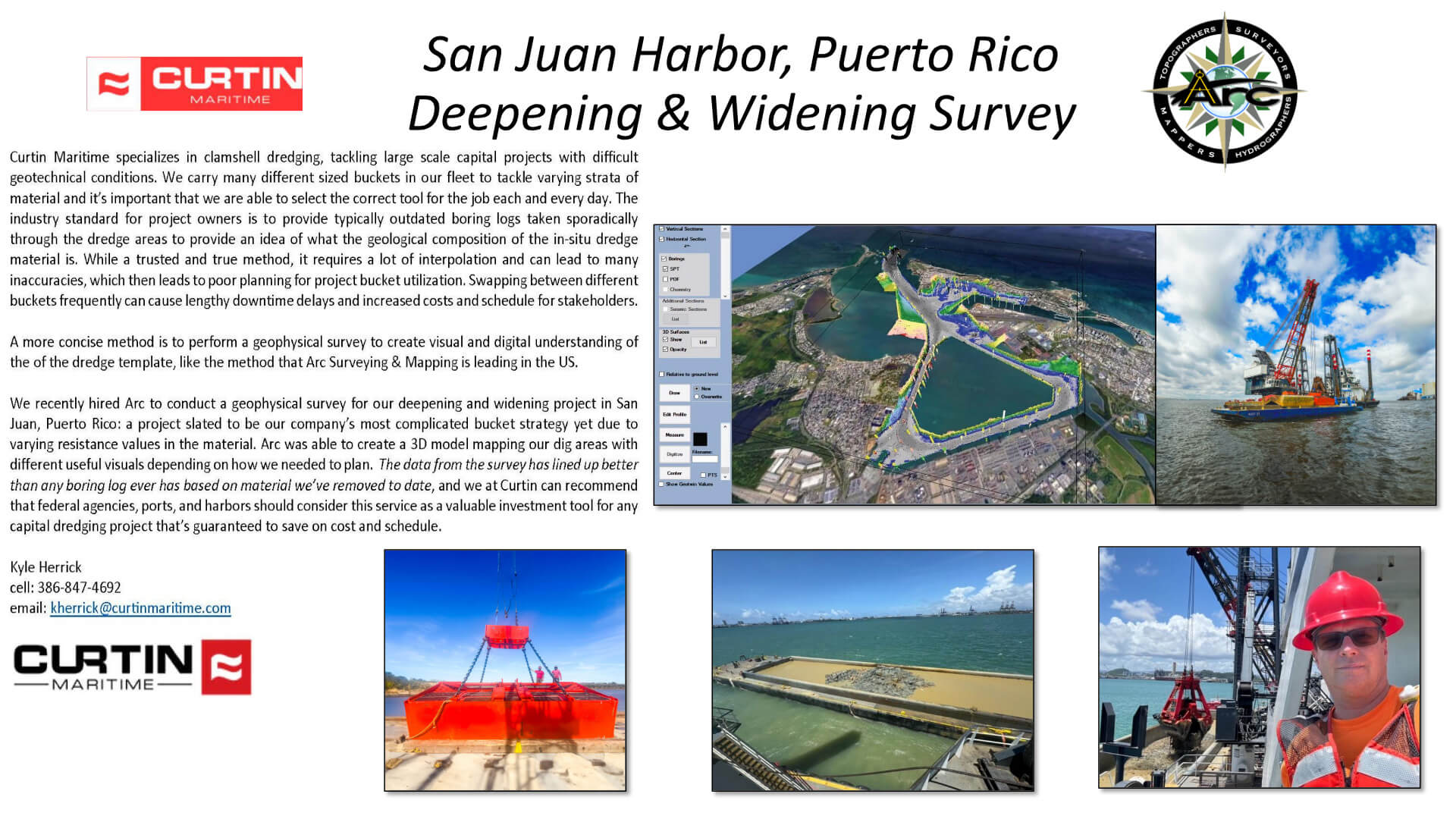
San Juan Project
Curtin Maritime specializes in clamshell dredging, tackling large scale capital projects with difficult geotechnical conditions. We carry many different sized buckets in our fleet to tackle varying strata of material and it's important that we are able to select the correct tool for the job each and every day.
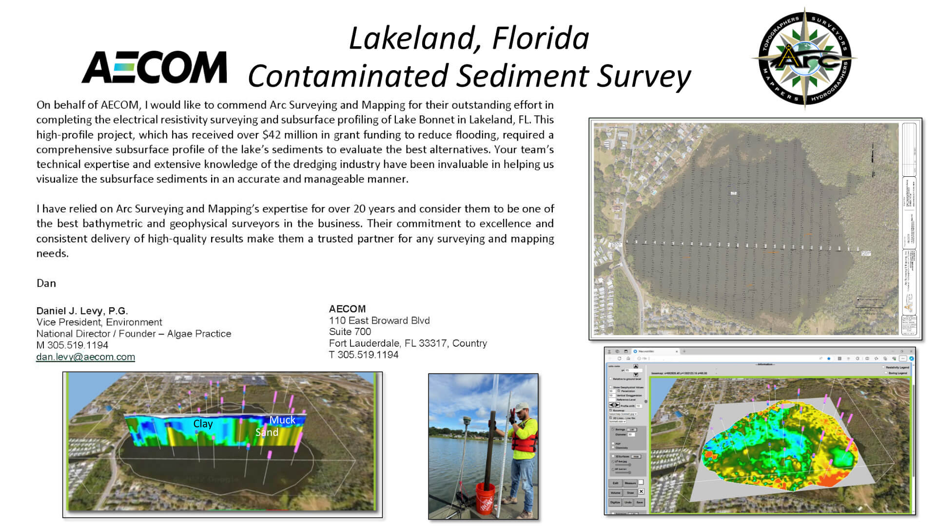
Aecom Project
On behalf of AECOM, I would like to commend Arc Surveying and Mapping for their outstanding effort in completing the electrical resistivity surveying and subsurface profiling of Lake Bonnet in Lakeland, FL
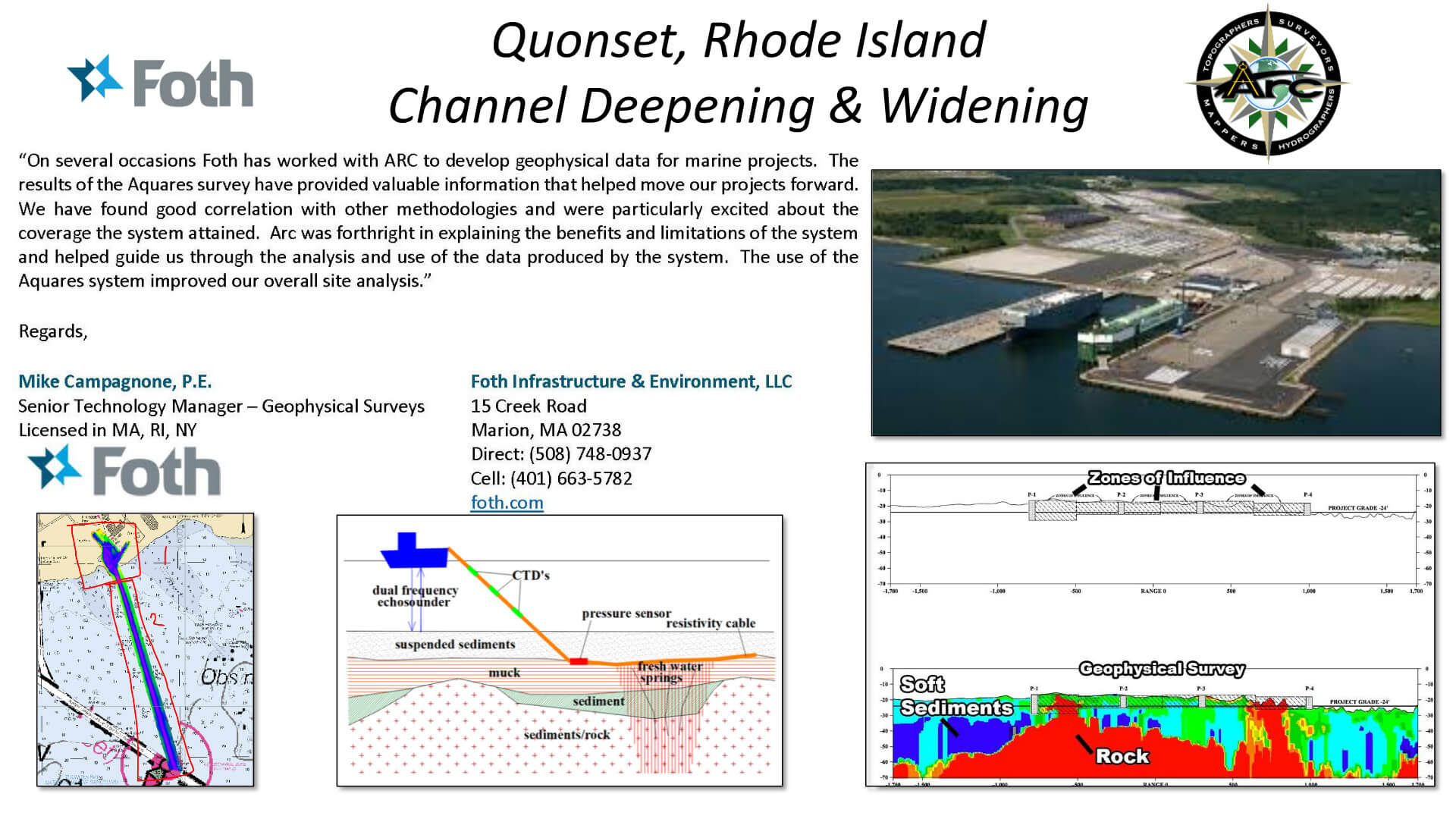
Quonset Project
On several occasions Foth has worked with ARC to develop geophysical data for marine projects. The results of the Aquares survey have provided valuable information that helped move our projects forward. We have found good correlation with other methodologies and were particularly excited about the...
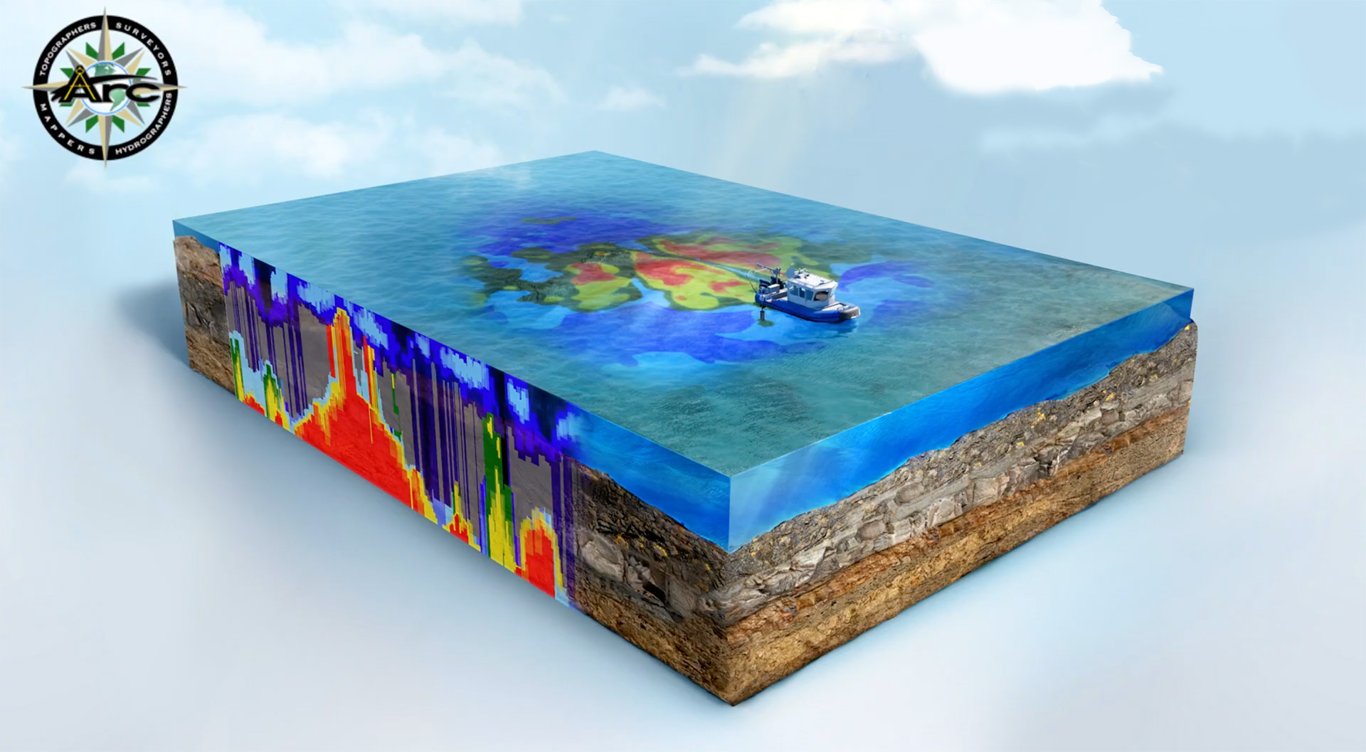
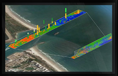
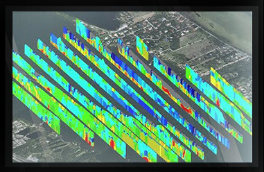
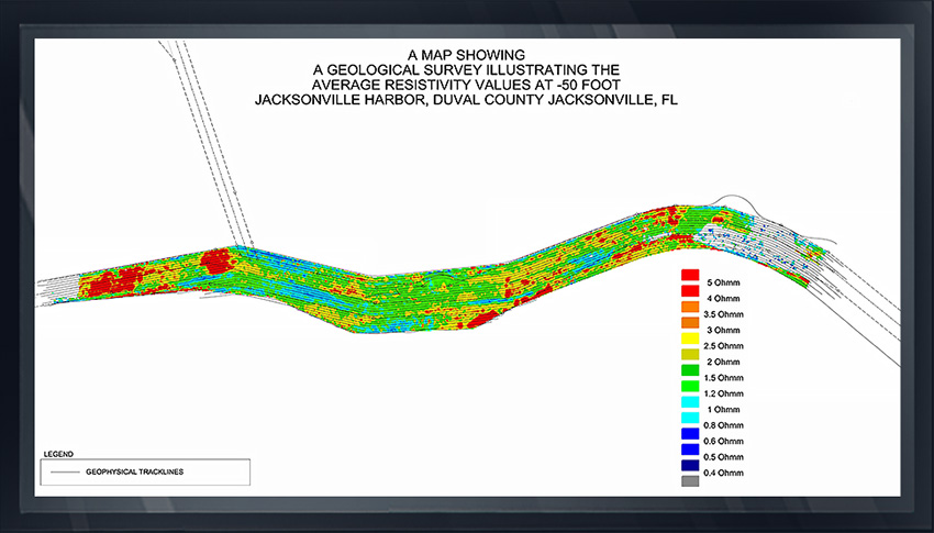
Arc Surveying & Mapping, Inc. provides geophysical surveys that describe the subsurface of marine environments.
Geophysical surveys are performed simultaneously with georeferenced bathymetry and provide a visual and digital understanding of subsurface structures utilizing Aquares, an advanced system that measures the resistivity of subsurface structures in Ohmm values.
Soft sediments will register low Ohmm resistance, while stiff clays and rock will register high resistance values.
Soft sediment layering is identified in the 3D Integrated Digital GroundModel (IDGM), enabling the identification of contaminated sediments with non-contaminated sediments and native bottom.
The model also provides a visual description of subsurface structures that is excellent for choosing boring geotechnical locations.
hydrographic, topographic, geophysical, static and mobile Laser scanning, shoaling surveys, probing, contaminated sediment surveys, acoustic doppler current profiling, quantity calculations, Blueview imagery, side-scan sonar imagery, condition, pre and post dredging surveys, chemical analysis, magnetometer surveys, deformation, emergency, structural monitoring, crane measurements, berth surveys, drone (UAV) LiDAR, video and photogrammetric inspection surveys, 3D Interactive modeling, asset management, geographic Information systems, GIS, AutoCAD, MicroStation