ENVIRONMENTAL REMEDIATION SURVEY
...
BAYOU CHICO, ESCAMBIA COUNTY FLORIDA
Arc Surveying & Mapping, Inc. has provided hydrographic and geophysical surveys of Bayou Chico, a waterbody located within the Pensacola Bay watershed in south central Escambia County.
The bayou has a surface water area of approximately 235 acres with a surrounding drainage basin of more than 6,600 acres. Bayou Chico is widely considered to be one of the most historically contaminated water bodies in Florida.
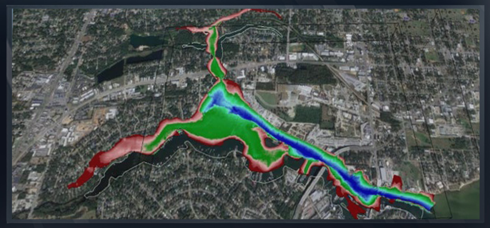
The purpose of the survey was to provide Escambia County with a 3D integrated digital ground model (IDGM) describing the current bathymetric and geophysical conditions of Bayou Chico, including legacy data such as probes, borings and chemical analysis, which data will assist in remediation planning.
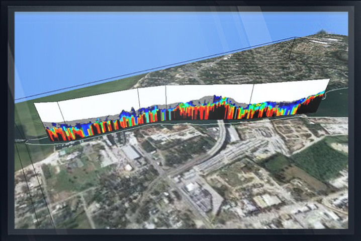
Within the model, the subsurface can be viewed in profile, cross sectionally, or horizontally illustrating sediment layering of any thickness.
...
Utilizing the model’s geophysical data and a few vibracore samples, an interface of contaminated and noncontaminated sediments is developed permitting surgical excavation.
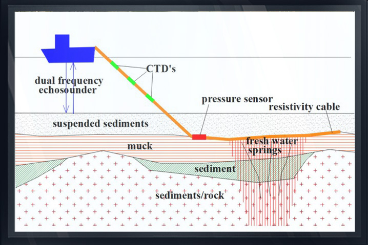
The Arc/Aquares geophysical surveying system measures the top of suspended sediments, firm bottom top of muck and subsurface structures to a depth of 40 feet below existing bottom. Within the model, users can select areas that require core borings to describe material types at each boring location using science.
Chemical test results can be viewed, and material type quantities can be computed.
For a video description click on https://youtu.be/3vR0WmLyErY