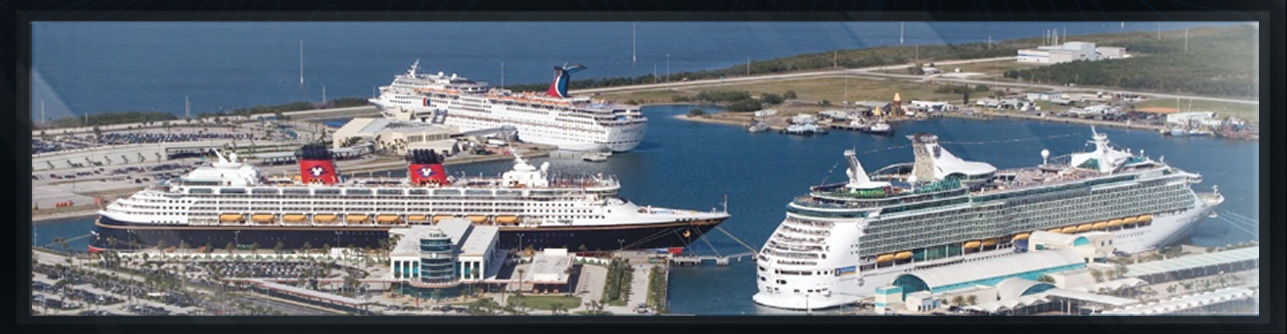
PORT CANAVERAL EXPANSION
...
CAPE CANAVERAL, FLORIDA
HYDROGRAPHIC SURVEY
The Canaveral Port Authority awarded Arc Surveying & Mapping a five year multidisciplined surveying services contract during 2013.
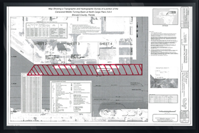
The contract required a hydrographic survey of the entire harbor, turning basins and berthing facilities, including the offshore disposal area.
CH2M Hill (Jacobs) furnished the deepening project design dredging templates and Arc computed quantities to project grade and over depth. The project required the excavation of 3,200,000 cubic yards, including overdepth, and was divided into fourteen Acceptance Sections.
At the completion of dredging each Acceptance Section, Arc performed a post dredge survey, assuring required grade was achieved. Within 24 hours of each survey, Arc provided the results of the survey to the Port, CH2M and the dredging contractor.
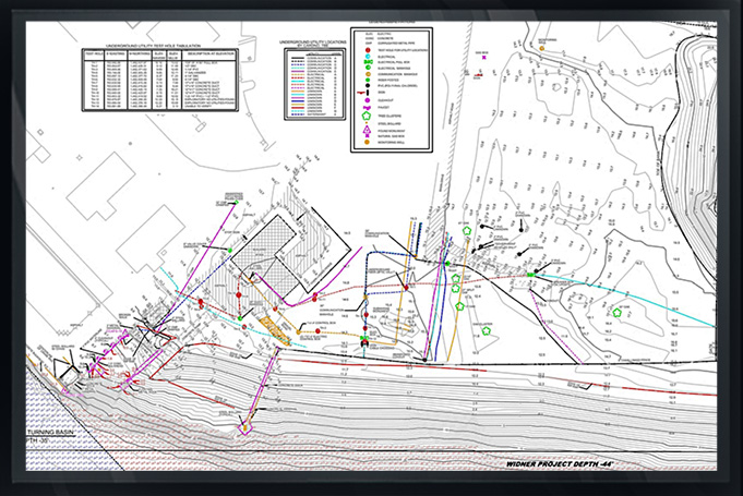
The construction project survey, mapping and quantity calculations were never in question regarding accuracy and payment by contractor. Arc has provided CH2M with numerous other types of surveys at Canaveral including topographic and ASCE standard utility surveys of existing berths for expansion.
Arc has surveyed proposed and existing disposal areas both on and offshore, and on the beaches at the Sand Bypass area and was awarded a separate contract by CH2M to provide hydrographic and topographic surveys for the design of new container and cruise ship berths.
Arc has also provided CH2M (Jacobs) and the Canaveral Port Authority with a geophysical survey utilizing the Arc/Aquares geophysical system.
The purpose of this survey is to describe 100% of material types within the subsurface for berth construction documents and to assist with the location and number of core borings necessary for the next expansion project.
(See the geophysical section of Arc’s website under Geophysical Surveys for more detail.)