DREDGING
...
KISSIMMEE RIVER, FLORIDA
Arc Surveying & Mapping, Inc. was contracted by Cajun Dredging to provide high resolution multibeam swath surveys at a Jacksonville District ACOE Kissimmee River Flood Control project near Okeechobee, Florida.
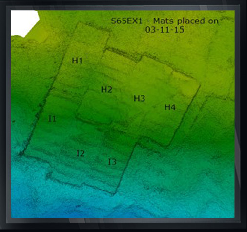
The project consisted of hydrographically locating prefabricated concrete mats after placement on the lake bottom and to certify accurate positioning and grades.
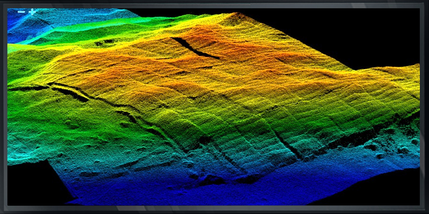
Arc located the mats after placement using a 23 ft. fully enclosed survey vessel equipped with a Reason 7125 multibeam system operating at 400 kHz, a POS WaveMasterw/IMU, and Trimble RTK/GPS for positioning while acquiring continuous water surface elevations.
Upon survey completion of each area, usually 4 to 6 mats, Arc hydrographers mapped the mats in a 0.1 x 0.1 foot matrix grid using MicroStation and Inroads to identify each mat corner, labeling and cataloging each.
In addition, per specifications, all gaps between maps exceeding one foot were identified for filling with stone.
Within 24 hours of survey, Arc submitted each day’s survey map to the Jacksonville District office, but typically delivered each within 12 hours.
Arc also performed as built surveys of the slope protection rip-rap that was placed, intersecting with the approved mat sections.