Before any successful construction project begins, it’s important to understand the land. That’s where topographic surveys come in. These surveys reveal the shape, features, and elevation of the ground. They guide everything from architectural design to grading and drainage.
In this blog, we’ll break down what topographic surveys are, how they’re conducted, and how they help your construction or development project stay on track. Whether you’re a homeowner, developer, contractor, or architect, this guide is your starting point.
What Is a Topographic Survey?
A topographic survey is a detailed and precise measurement of the natural and manmade features of a piece of land. It includes information about the terrain, elevation changes, vegetation, structures, roads, utilities, and water bodies.
The survey results are presented in the form of a topographic map, which shows elevation changes using contour lines. This map is essential for any project that involves changing or building on the land. It gives designers, engineers, and builders a clear understanding of the site’s existing conditions.
Why Are Topographic Surveys Important?
A topographic survey provides a foundation for smart design. It supports decision-making during every phase of a project. Without one, there’s a higher risk of unexpected problems, added costs, or delays.
Let’s explore how these surveys make a difference:
1. Improved Site Planning
Topographic surveys give a clear picture of the land’s layout. With this information, project teams can decide how best to use the land. They can identify challenges such as steep slopes, uneven terrain, drainage issues, or nearby structures. This knowledge helps determine if the site is suitable and what adjustments are needed.
2. Accurate Design
Designers need to work with the land—not against it. A topographic map allows architects and engineers to design structures that follow the natural elevation and flow of the site. This can reduce the need for excavation or fill, which saves money and minimizes environmental impact.
3. Easier Permitting Process
Many municipalities require topographic surveys when applying for construction permits. These surveys support environmental studies, stormwater management plans, and zoning approvals. Providing this data early helps speed up approvals and avoid rework.
4. Safer and Smoother Construction
Construction teams rely on topographic surveys for precise excavation, grading, and placement of foundations. Knowing the elevations and contours helps contractors avoid errors and prevent damage to underground utilities or natural features.
5. Better Communication Between Teams
With one accurate topographic map, everyone involved in the project—from designers to builders—has access to the same data. This shared understanding improves collaboration and reduces miscommunication.
What Does a Topographic Survey Include?
A topographic survey can include a wide range of details, depending on your project’s needs. Most surveys include:
- Ground elevation and contour lines
- Trees, shrubs, and other vegetation
- Existing structures like buildings, fences, and walls
- Roads, driveways, sidewalks, and curbs
- Rivers, lakes, ponds, and drainage ditches
- Utilities, poles, fire hydrants, and manholes
- Property boundaries (if requested)
This information is usually shown in 2D or 3D drawings. These maps are used throughout the design, engineering, and building process.

How Are Topographic Surveys Conducted?
Topographic surveys are conducted by licensed land surveyors using advanced tools and methods. Here’s how the process typically works:
Step 1: Research and Planning
Surveyors begin by gathering information about the site. They may review existing maps, land records, construction documents, and previous surveys. This step helps define the scope and identify any specific requirements.
Step 2: Field Data Collection
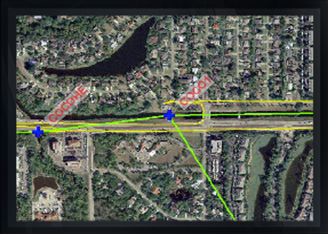
The surveyors visit the site with specialized equipment. They use tools like GPS receivers, total stations, and 3D laser scanners to record measurements. For large or hard-to-reach areas, drones may also be used to collect aerial data.
Every detail—elevation points, terrain changes, natural features, and manmade objects—is recorded with high precision.
Step 3: Data Processing and Mapping
Back at the office, surveyors use software like AutoCAD or Civil 3D to process the collected data. They create a detailed topographic map that shows contour lines, elevations, and labels for each feature.
The final output is delivered in digital and print formats. These deliverables are ready for architects, engineers, and contractors to use immediately.
Want to see how professional topographic surveying works in real-world conditions? Visit Arc Surveying & Mapping, Inc. to explore our full range of surveying services.
When Should You Order a Topographic Survey?
There are many scenarios where a topographic survey is not just useful—it’s necessary.
You should consider a survey if:
- You’re building a new home, commercial building, or road
- You plan to develop raw land or subdivide a property
- You need to design a stormwater or drainage system
- You’re applying for zoning or building permits
- You want to improve site grading or manage runoff
- You need a foundation for design and construction planning
If the project affects the terrain, a topographic survey is likely required. It’s better to get the data early than to face costly surprises later.
Topographic Surveys vs. Boundary Surveys
Many people confuse topographic surveys with boundary surveys. While both involve land measurement, they serve different purposes.
A topographic survey maps the features and elevations of the land. It’s focused on physical conditions and how the land looks and functions.
A boundary survey defines the legal property lines. It’s used for ownership verification, legal disputes, and title insurance.
In many cases, you may need both. For example, if you’re building near the property line, it’s smart to verify the boundaries and the terrain at the same time.
Real-Life Applications of Topographic Surveys
Topographic surveys are used in nearly every type of development project. Here are just a few examples:
Road and Highway Projects
Engineers use topographic data to design roadways that follow the natural grade. This reduces the amount of earthwork and helps with drainage planning.
Land Development
Before land is divided into lots or built upon, developers need to understand how the terrain affects layout, access, and utility installation. A topographic survey is the first step in that process.
Stormwater Management
To design effective drainage systems, engineers need to see how water flows across the site. Topographic maps help them plan swales, retention ponds, and culverts.
Building Design
Architects use elevation data to position buildings correctly. They may want to maximize views, avoid low-lying areas, or reduce foundation costs. A topographic map provides the needed insight.
Environmental Assessments
Some projects require studies to assess the impact on wetlands, trees, and water bodies. Topographic surveys supply critical data for these evaluations.
Choosing a Trusted Surveying Partner
Not all surveying companies are the same. When choosing a firm for your topographic survey, look for:
- A team with licensed and experienced surveyors
- Use of modern tools and technology, including GPS and drone mapping
- Clear and precise deliverables in the format your project requires
- Local knowledge of permitting and zoning requirements
- A track record of reliable communication and fast turnaround times
At Arc Surveying & Mapping, Inc., we bring more than 30 years of experience to every project. Our team works with homeowners, contractors, engineers, and municipalities across the Southeast and beyond.
We take pride in delivering accurate topographic surveys that help projects start strong and stay on track.
Ready to take the next step? Contact our team to request a quote or schedule a consultation.
Explore More on Topographic Surveying
To dive deeper into the standards and best practices behind topographic surveys, check out resources from the National Society of Professional Surveyors. They provide guidelines, certifications, and updates that shape the industry today.
Final Thoughts
Topographic surveys are more than just maps—they’re planning tools that reduce risk and improve results. They support efficient design, secure permitting, and precise construction.
No matter the size of your project, starting with a professional topographic survey gives you the clarity you need to move forward with confidence.
Don’t guess—measure. And let the experts at Arc Surveying & Mapping, Inc. guide the way.