FREEPORT HARBOUR COMPANY SURVEYS
...
FREEPORT, GRAND BAHAMA ISLAND
TOPOGRAPHIC AND BATHYMETRIC SURVEY
Arc Surveying & Mapping, Inc. has performed topographic and bathymetric projects for the Freeport Harbour Commission (FHC) at Grand Bahama Island for more than fifteen (15) years.
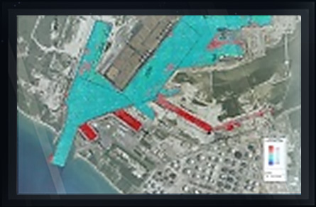
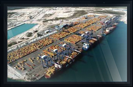
Arc performs Freeport Harbour bathymetric surveys for charting to NOAA and British Admiralty standards. Freeport Harbour is continuously expanding and was well ahead of the curve regarding preparation of the Panama Canal expansion. Currently to a depth of 65 feet, FHC berths are the largest container ships in the world.
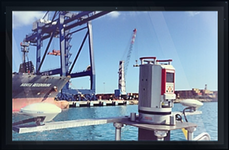
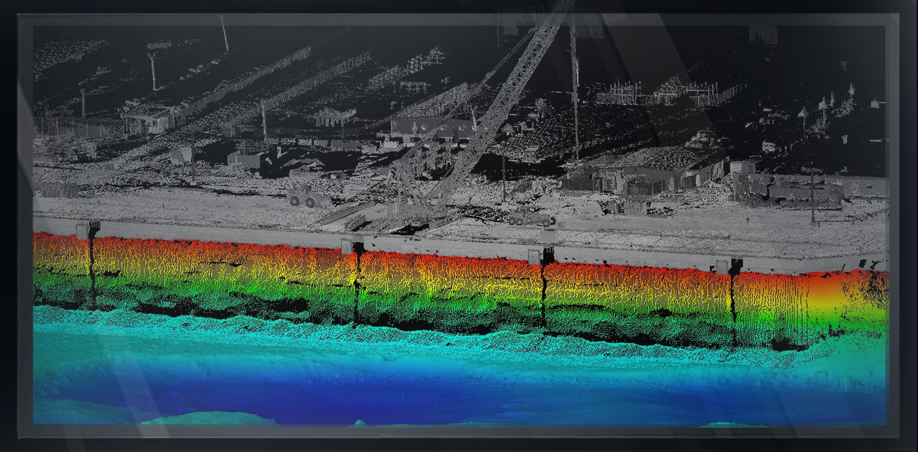
As part of the expansion, FHC constructed new berthing areas such as those pictured. Using a combination of high resolution multibeam swath soundings and mobile terrestrial laser scanning, combined with precise positioning and motion compensation, all configured through Hysweep.
Arc provided the models and maps necessary for construction in many formats including AutoCAD, MicroStation, Polyworks, Topo Dot and others.
CLICK HERE FOR VIDEO
The existing shoreline of Freeport Harbour had been excavated by draglines, leaving a very irregular vertical slope and caverns in the soft coquina rock.
The data Arc provided allowed construction designers to visualize the new bulkhead sheeting along the irregular rock face. Sheeting was driven and grout filled, including the cavities.
Topographic data from the survey vessel was supplemented with static data to provide full coverage of the above water construction site. Backscatter data from the multibeam survey was used to determine bottom surface grain size of sediment.