ST THOMAS, USVI NOAA
...
HYDROGRAPHIC SURVEYING
Arc Surveying & Mapping, Inc., has been providing the U.S. Virgin Island Port Authority with quick response hydrographic data acquisition and mapping products since 1999.
These services have included the updates to bathymetric conditions associated with charting in channel approach and berthing facilities, channel deepening projects and dredge maintenance projects within the limits of responsibility for the USVI Port Authority.
These limits include facilities on St. Thomas, St. Croix and St. Johns. Data acquisition performed with numerous models of Reson’s Seabat Mulitbeam systems including models 8124, 7101 and 7125.
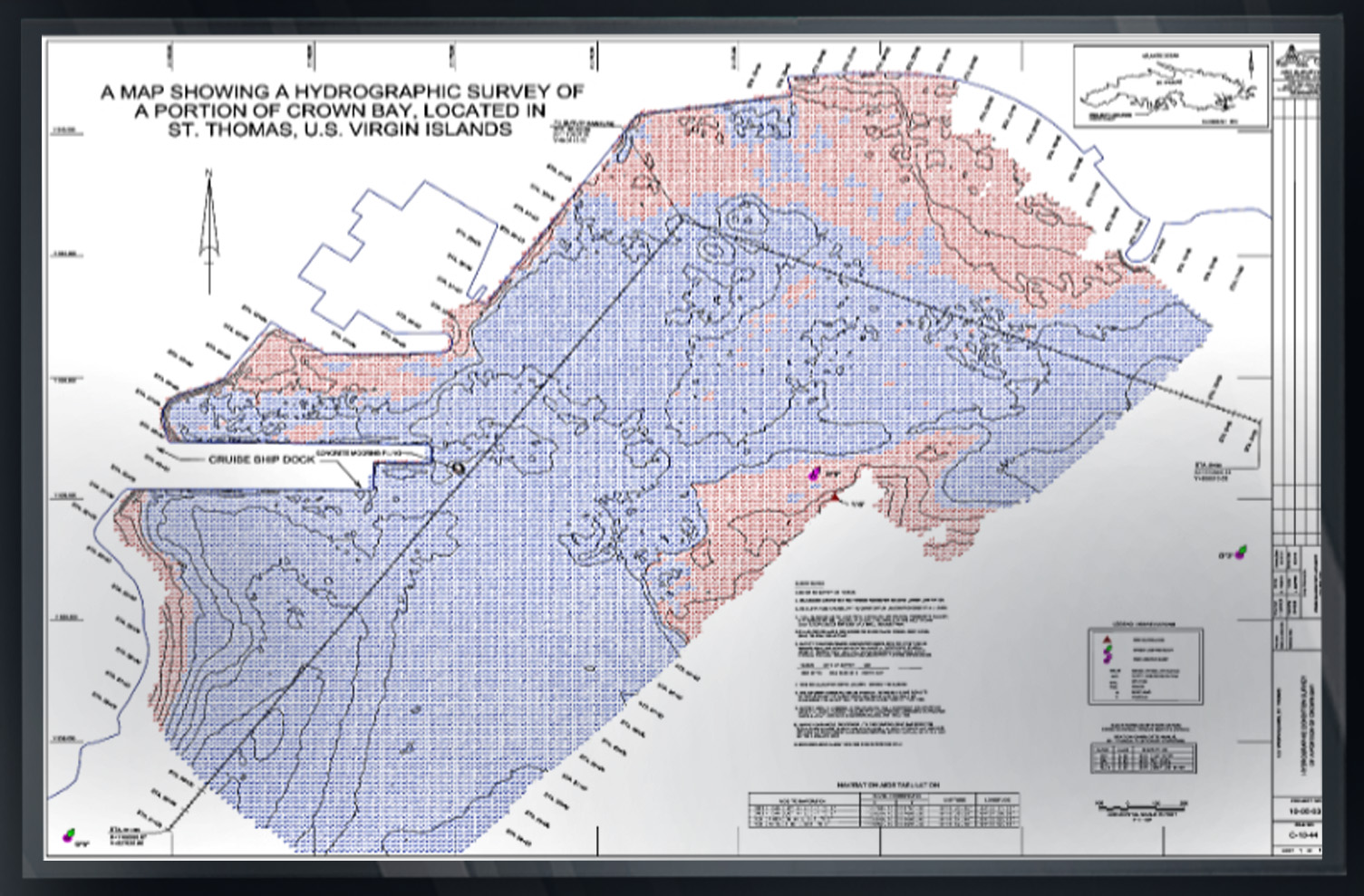
Arc completed and provided multibeam hydrographic data acquired to National Oceanic and Atmospheric Administration (NOAA) standards and provided compliant reports and data to the NOAA charting office.
This data was accepted and approved for the use of updating existing navigation charts performed by NOAA and provided to Port and Shipping interests utilizing the area of interest.