POST HURRICANE SURVEY
...
TYBEE NORTH BEACH
Arc Surveying and Mapping Inc. (Arc) was contracted by the Town of Tybee Island, through their Coastal Engineering firm Olsen Associates, Inc., to perform emergency Post Hurricane storm assessment surveys along the north shore of Tybee Island, Georgia.
The survey results were utilized for a two-fold purpose.
One, for the estimated volume lost to be reported to FEMA for use by the town in recovery of project cost lost to the storm and two, for the engineering design of dune restoration along a portion of heavily populated stretch of beach homes and condominiums.
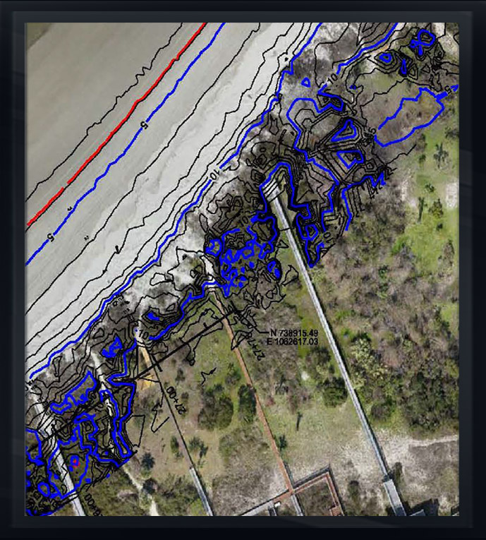
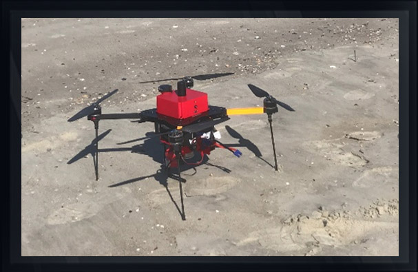
Due to the need for a quick response for the survey results, Arc utilized one its MD-4 survey grad quad copters configured with a V-Map GPS system allowing for submittals of a digital rectified orthometric aerial of the project site, as well as a 3-D point cloud obtained from processing of the over 300 images obtained with a Sony A6000 24-megapixel camera configured to the aerial platform.
The final point cloud delivered was verified to ground control and was within an accuracy tolerance of less than 3 centimeters.
The use of Arc’s MD-4 quad copter allowed for the engineering analysis of 100% of the dune system as well as quantifying damage to beach access structures and loss of dune vegetation.
In this case, Arc was able to compare the drone collected data to previous data collected conventionally in years 2016 and 2014 for quality control and equipment varification.
The use of the drone saved our client thousands of dollars while still achieving and/or exceeding accuracy requirements.