
KINGS BAY NAVAL BASE
...
KINGS BAY, GEORGIA
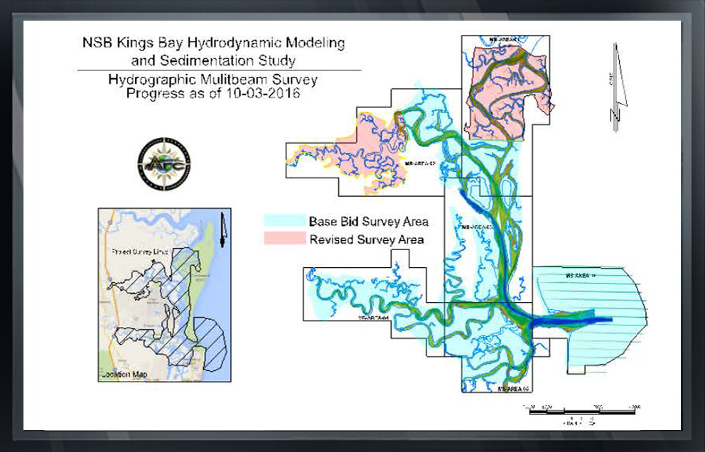
During 2016, Arc was awarded a contract as a NAVFAC sub-contractor to Versar to perform a multi task hydrographic survey at the Kings Bay Naval Base in Georgia.
Arc performed multibeam and singlebeam bathymetric surveys of channels and tributaries within the 92-square mile estuary of Kings Bay
The purpose of the survey was to devise a hydrodynamic model and study to determine methods of decreasing shoaling in the Kings Bay NSB navigation channels.
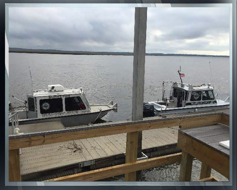
Arc provided three fully equipped survey vessels, surveying the shorelines at high tidal periods in order to obtain survey data overlap with LiDAR data acquired by others.
Arc’s survey boats were equipped with an Applanix POS MV inertial positioning unit and Reson 7125 Dual Frequency Multibeam sounders operating at a frequency of 200khz.
The ACOE GPS/RTK transmitting station at Kings Bay and Arc base station points established throughout the project area were utilized to transmit RTK (Real Time Kinematic) corrections to the survey boats.
Hydrographic data were collected and processed utilizing Hypack and Hysweep navigation and processing software.
Vessel calibrations and patch tests were performed and documented prior to the start of each multibeam survey.
In addition to the multibeam survey, low frequency (28khz) single beam profiles were taken in areas where suspended sediments were suspected.
Arc Surveying & Mapping has received an Exceptional rating by NAVFAC for its work at Kings Bay and completed the project on time and within budget despite delays caused by Hurricane Matthew Emergency Bridge surveys required by FDOT.
Deliverables included xyz files; log sheets, field books, and meta data files.