
Property disputes are more common than many people think. Whether you’re a homeowner, land buyer, or developer, a boundary dispute can lead to long delays, broken relationships, and expensive lawsuits.
The good news? These problems are often avoidable. A boundary survey is one of the most effective tools to protect your property and your wallet.
In this blog, we’ll explain how a boundary survey works, why it matters, and how it prevents costly litigation. If you’re buying, selling, building, or subdividing land, this guide is for you.
What Is a Boundary Survey?
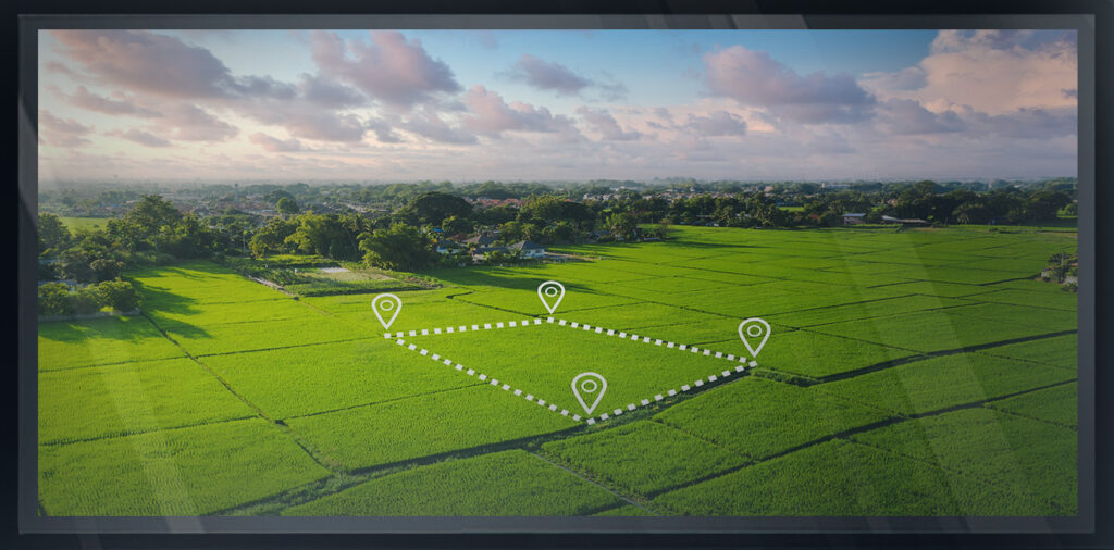
A boundary survey is a detailed, professional mapping of your property’s exact legal lines. It confirms where your land begins and ends based on the legal description in your deed and historical property records.
A licensed land surveyor uses tools like GPS, total stations, and historical maps to identify these boundaries with precision. The result is a survey map showing:
- – Property corners
- – Boundary lines
- – Any encroachments (like fences or buildings crossing the line)
- – Easements (such as utility rights of way)
This clear definition of your land gives you the confidence to use it, build on it, or sell it without legal risk.
Why Boundary Disputes Happen
Boundary disputes happen when two parties disagree about the location of a property line. These issues can come from:
- – Misunderstood deed descriptions
- – Outdated or missing surveys
- – Fences or driveways built on the wrong side
- – Encroachments that go unnoticed for years
- – Easements not shown on the current title
Disputes can escalate fast. If one property owner believes their land is being used without permission, they may file a lawsuit. This can lead to court-ordered surveys, property loss, or forced removal of structures.
Litigation Is Expensive – But Avoidable
Property lawsuits are time-consuming and costly. According to Forbes, litigation over land boundaries can cost tens of thousands of dollars and drag on for months or even years.
The emotional toll is also significant. Disputes can strain relationships with neighbors and create stress during what should be simple transactions or projects.
But here’s the truth: Most of these lawsuits could have been avoided with a professional boundary survey conducted early in the process.
How a Boundary Survey Prevents Legal Trouble
Let’s walk through exactly how a boundary survey prevents disputes and protects you from future problems.
1. Clarifies Legal Ownership
A boundary survey removes the guesswork. It provides a clear and certified map of your land’s dimensions and corners. This eliminates confusion between you and adjacent landowners.
2. Reveals Encroachments
Surveys can show if neighboring structures cross your property line—or if yours cross theirs. Identifying these issues early allows you to correct or negotiate them before a lawsuit happens.
3. Supports Property Transactions
When buying or selling property, a boundary survey can prevent disputes at closing. Buyers feel more confident, and sellers protect themselves from future claims.
At Arc Surveying & Mapping Inc., we’ve helped clients across Florida ensure their real estate transactions are safe and legally sound.
4. Assists in Building Permits
Planning to build a fence, addition, or new structure? Local permitting offices often require a survey to confirm your project won’t encroach on neighboring properties. Skipping this step can lead to stop-work orders—or worse, lawsuits.
5. Avoids Costly Mistakes
Fixing a boundary error is far more expensive than preventing one. Legal fees, court costs, and demolition orders are just some of the potential consequences of building on the wrong land.
When You Should Get a Boundary Survey
You don’t need to wait until something goes wrong. The best time to get a boundary survey is before any of the following:
- – Purchasing a property
- – Selling land
- – Building a new structure
- – Installing a fence or driveway
- – Subdividing property
- – Resolving a neighbor’s complaint
If you’re unsure about your property lines, it’s better to be proactive. A survey today is a small cost compared to a future legal bill.
Choosing the Right Surveyor Matters
Not all surveys are equal. A cheap or outdated survey may not hold up in court. That’s why it’s essential to hire a licensed land surveyor who understands the local laws and regulations.
At Arc Surveying & Mapping Inc., we bring over 30 years of experience serving clients throughout Florida. Our surveys are thorough, compliant, and court-admissible.
Our services also include:
- – ALTA/NSPS land title surveys
- – Topographic surveys
- – Construction layout surveys
- – FEMA elevation certificates
Whether you’re a private landowner or a large-scale developer, we tailor our work to meet your project’s needs.
Real Example: Preventing a Legal Dispute in Jacksonville
Recently, a client in Jacksonville was preparing to build a pool and guest house. They assumed their backyard extended 20 feet beyond their fence. Before breaking ground, they hired our team for a boundary survey.
We discovered that part of their assumed land actually belonged to the neighbor. Without our survey, they would have built an illegal structure and triggered a lawsuit.
Thanks to early action, they adjusted their plans, avoided a conflict, and saved thousands in potential legal costs.
Don’t Guess. Survey First.
If you’ve never had your property surveyed, now is the time. Especially if:
- – Your deed description is unclear
- – Your neighbor questions your boundary
- – You plan to build or develop the land
- – Your property hasn’t been surveyed in years
A boundary survey is a small investment with long-term protection.
Let Arc Surveyors Help You Stay Out of Court
At Arc Surveying & Mapping Inc., we believe landownership should bring peace of mind—not legal problems.
Our licensed surveyors provide fast, accurate boundary surveys across Florida. We help homeowners, realtors, developers, and attorneys protect property rights and avoid expensive litigation.
We also offer topographic and ALTA surveys for more complex projects.
Ready to protect your property?
Contact Arc Surveyors now for a free estimate or to schedule your boundary survey.
Additional Resources
Want to learn more about land disputes and your legal rights?
Check out this Florida Bar guide on boundary disputes for helpful information.
Final Thoughts
Boundary disputes are serious—but preventable. Don’t leave your property lines up to guesswork. A professional boundary survey provides the clarity and protection you need to move forward with confidence.
Whether you’re buying, building, or simply protecting what’s yours, surveying your land is the smartest move you can make.